FRASER ISLAND
|
Fraser Island is the largest sand island in the world and is in the state of Queensland on the east coast of Australia. Hervey Bay is formed by the junction of the mainland and Fraser Island. There is some confusion over the term, "Hervey Bay". ( Pronounced as Harvey Bay ) Hervey Bay City consists of a series of suburbs, that were once fishing villages. It has grown to encompass areas inland towards Maryborough, along the coastal strip north to the Burrum River and south to the Mary River. The population was around 3,000 when I first visited Hervey Bay as a child in the 1950's and now , 2003, is around 40,000. The suburbs have built up along the beachfront of the physical formation called a bay, which was named Hervey Bay by Captain James Cook in the late 1700's. Of the earliest suburbs settled, Pialba, Scarness, Torquay and Urangan became the business area suburbs. Point Vernon was settled early too but became a very popular residential area because of the views across the bay to Fraser Island. Other suburbs or areas that I am aware of include Burrum Heads ( at the head of the Burrum River ), Howard, Torbanlea, Toogoom, Takura, Dundowran, Nikenbah, Kawungan, Shelly Beach, Bingham and River Heads ( at the head of the Mary River ). Because tourists were confused over where the town/city of Hervey Bay was, the Pialba Post Office ( Australia Post ) was renamed as Hervey Bay Post Office. Fraser Island runs away to the north east of the mainland and part of it is in the Hervey Bay City Council area. Below is an excerpt from a Urangan State High School webpage. Obviously they have researched the history well.
Hervey Bay, a town created by the early pioneers from England and Europe has certainly prospered since the late 17 hundreds. Being only 230 years old, Hervey Bay has a quite remarkable history starting from the moment Captain Cook discovered Australia in 1770. Hervey Bay actually originated with the name 'Hervey's Bay', which Cook named in honour of his friend in England, Captain Hervey, the Earl of Bristol. As Cook sailed up the east coast of Australia, he passed what is now called Fraser Island, and mistakenly thought it was a part of the mainland. But in 1799 Mathew Flinders discovered the passage between Fraser Island and named Fraser, 'Great Sandy Island'.
Access to Fraser Island is by 4WD (Four Wheel Drive) vehicles which are transported on barges that leave from Hervey Bay. (Access is also available at the southern tip of the island at Inskip Point near Rainbow Beach which is east of Gympie.) It has great forests and fresh water lakes. Most of it is National Park. There is excellent bushwalking, though care must be taken as poisonous creatures are found there. One particular species is a small deadly snake, the Death Adder. It sometimes suns itself on the walking tracks. It is only around 12 inches/300mm in length and is easily stood on. It also hides in leaf litter waiting for its prey and obviously there is a LOT of leaf litter on the island. Both the eastern (ocean) and western (bay) beaches are accessible, though certain areas are off limits. The ocean side has surf due to being exposed to the Pacific Ocean whereas the bay side is less turbulent being sheltered from the ocean by the island. Fresh water seeps out of the beach sand in many places. Visitors often create small holding ponds in the sand and use the fresh water captured to wash off the salt left on them from the sea water.
While living in the city of Hervey Bay, being an electrician, I was asked to wire a couple of houses on Fraser Island. Due to the time involved driving to the island and back, the owner was prepared to pay for me to be flown to his property on the island, situated at one of the settlements named Happy Valley. The plane had to be landed on the beach, a very exciting but hair raising event. The plane was flown by a great pilot, Gerry Geltch. I have no connection with Gerry, only the fact that he flew me to the island to do the work on the required occasions. I enjoyed his company on the flights to the island and felt very safe with him in control of the plane. This link is to the business, which I assume he still runs - Air Fraser Island
I took the pictures below on one of the flights to the island. ( Click on the pictures that have a red eye to see a larger picture ) |
|
|
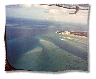
It runs between Woody Island and Fraser Island and carries the outflow from the Mary River which runs out into Hervey Bay. Moon Point, on the west beach of Fraser Island, can be seen on the right side of the picture. The waters of Hervey Bay are at the top of the picture.
|
|
.
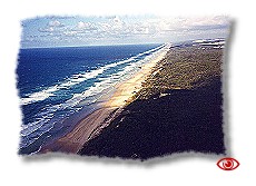
The view along the east beach. |
|
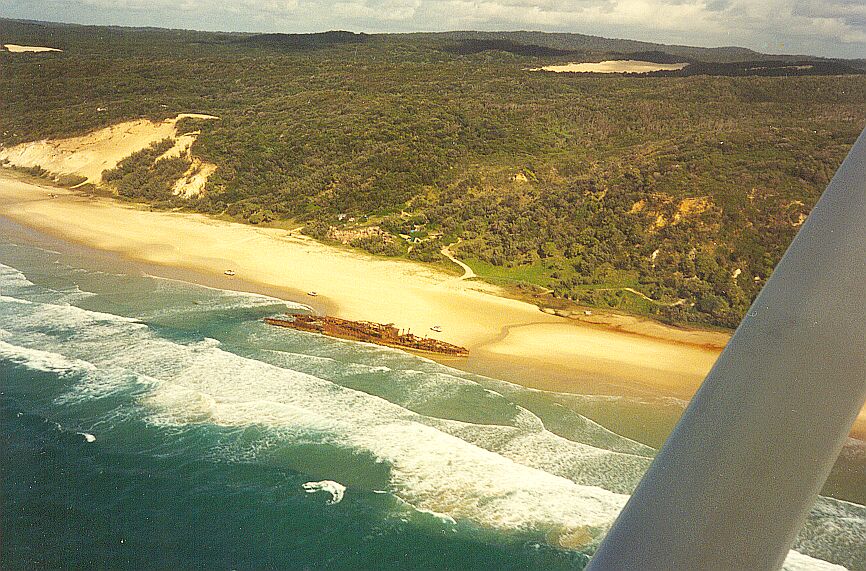
Below is the Maheno shipwreck on the east
beach. It was washed ashore during a cyclone
in 1935.
|
|
|
|
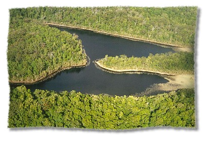
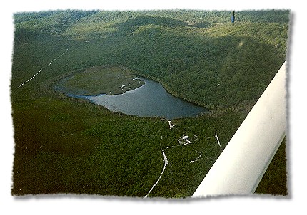
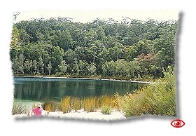
Below are some of the many freshwater lakes on Fraser Island.
|
|
Also in view are a number of the maze of tracks that wind their way through the sand island carrying the 4WD traffic.
|
