|
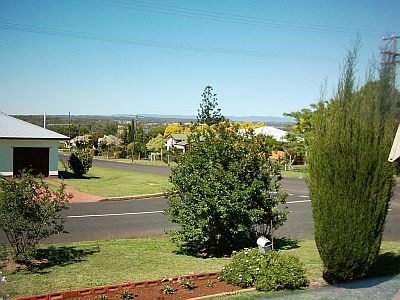
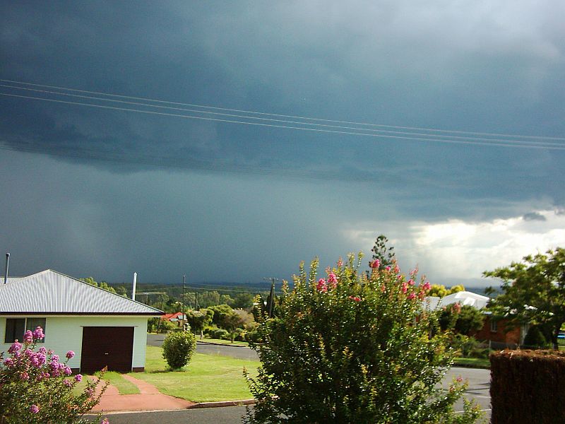
Official readings for Kingaroy are taken at the Kingaroy Airport. 94549 - KINGAROY AIRPORT - 151.8398°E, 26.5737°S, 434m ASL KINGAROY Town - 151.5072°E, 26.3232°S, 437m ASL The rainfall ( in mm ) reported here is read from a commercial rain gauge mounted in the open on a post 2 metres off the ground at our home in Kingaroy itself, some 5km from the Kingaroy Airport. In the pictures below, the Bunya Mountains can be seen in the background. Spectacular storms form behind them and pass across the farmlands between Kumbia - which is a few kilometres from the foothills of the Bunyas - and Kingaroy. (The Kingaroy Airport is off picture about mid picture on the left side) In my teenage years, around the mid to late 1960's, I saw the results of some of those storms. In one storm, 6 inches / 150mm fell in less than 2 hours, washing a lot of soil off the cultivated paddocks.
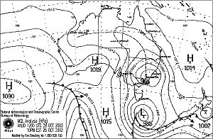
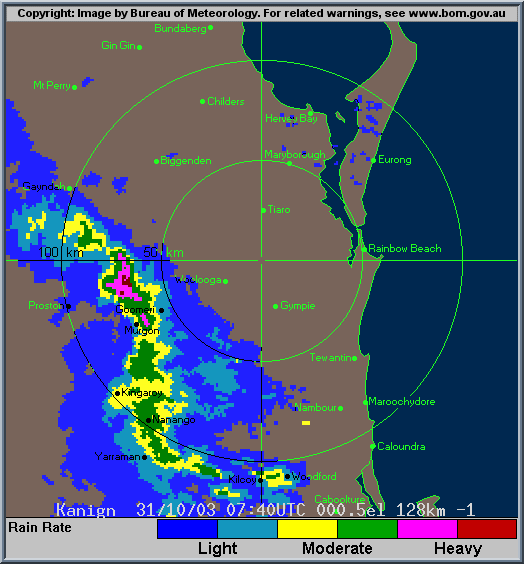
(1) (Credit to Weatherzone - www.weatherzone.com.au )
Heavy rain and storms in
QLD
Windy and dusty in QLD and
NSW
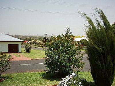
The dust can be seen obscuring the Bunya Mountains. The top wind gust recorded at the airport was 34 knots at 10.17pm. According to the BOM, the line of thunderstorms was moving through our area at around 100kph. There was a very good lightning show with the storms as well!
(Credit to Bureau of Meteorology - http://www.bom.gov.au) (3) (Credit to Bureau of Meteorology - http://www.bom.gov.au)
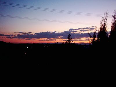
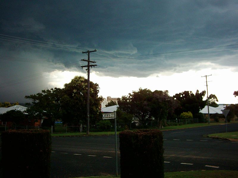
The lightning in this storm was reminiscent of the type I saw in the 50's and 60's. There were at least 10 cloud to ground strikes in the town area close enough to me to cause the thunder immediately I saw the brilliant thick silver streak hit. I saw one strike no more than 5 blocks away that caused a mist or smoke to rise a few seconds after it hit ground. The rain lasted no more than 20 mins. (4) Click here to see a short video ( 6 seconds / 560k/ .avi ) of the rain event at 1.25pm - 12-11- 03.
(5) Below are a few pics of the storm which came in from the South East.
Click on the pictures for a larger view
As it moved Westwards, South of Kingaroy.
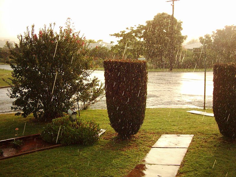
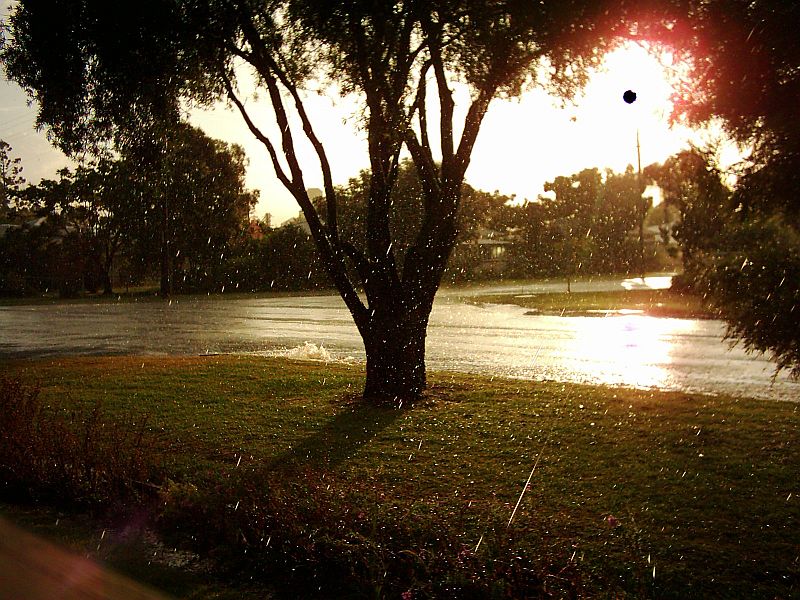
A Sun Shower after the heaviest rain had passed.
That black spot is the sun, shining brightly from the edge of the clouds as the Sun Shower continued and the remains of the downpour ran down the gutter.
The back end of the storm as it headed Northwards.
Readings were taken at 9.00 am |
||||||||||||||||||||||||||||||||||||||||||||||||||||||||||||||||||||||||||||||||||||||||||||||||||||||||||||||||||||||||||||||||||||||||||||||||||||||||||||||||||||||||||||||||||||||||||||||||||||||||||||||||||||||||||||||||||||||||||||||||||||||||||||||||||||||||||||||||||||||||||||||||||||||||||||||||||||||||||||||||||||||||||||||||||||||||||||||||||||||||||||||||||||||||||||||||||||||||||||||||||||||||||||||||||||||||||||||||||||||||||||||||||||||||||||||||||||
|