| Official readings for Kingaroy are taken at the Kingaroy Airport. 94549 - KINGAROY AIRPORT - 151.8398°E, 26.5737°S, 434m ASL
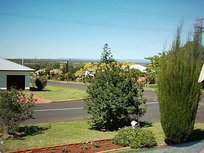
KINGAROY Town - 151.5072°E, 26.3232°S, 437m ASL The rainfall ( in mm ) reported here is read from a commercial rain gauge mounted in the open on a post 2 metres off the ground at our home in Kingaroy itself, some 5km from the Kingaroy Airport. In the pictures below, the Bunya Mountains can be seen in the background. Spectacular storms form behind them and pass across the farmlands between Kumbia - which is a few kilometres from the foothills of the Bunyas - and Kingaroy. (The Kingaroy Airport is off picture about mid picture on the left side) In my teenage years, around the mid to late 1960's, I saw the results of some of those storms. In one storm, 6 inches / 150mm fell in less than 2 hours, washing a lot of soil off the cultivated paddocks.
9.44am 22-10-2003
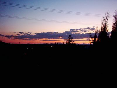
7.29pm 12-11-2003
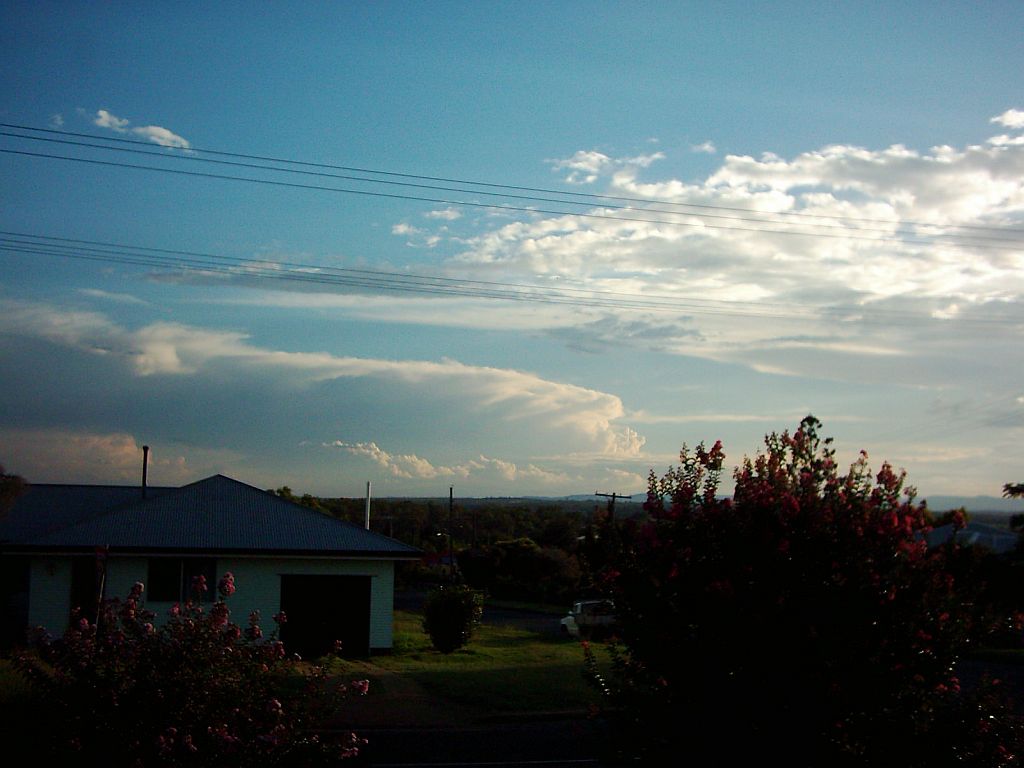
4.27pm 24-01-2004 (1) After a really humid day, at around 1 am on the 25th, a line of storms passed over Kingaroy.
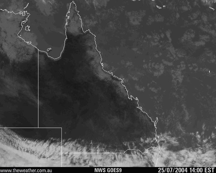
2.51pm 25-07-2004 21.5 C - 38% RH - WNW 9kt - 1018.3 hPa
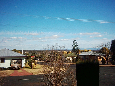
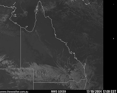
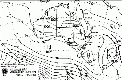
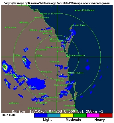
5.00pm 17-10-2004 17.5 C - 72% RH - ENE 8kt - 1017.1 hPa
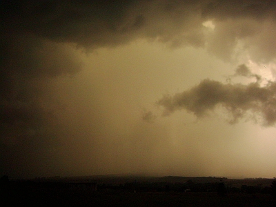
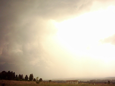
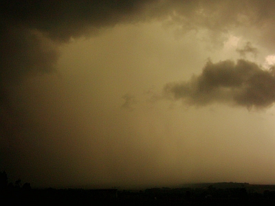
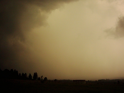
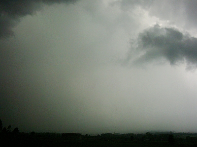
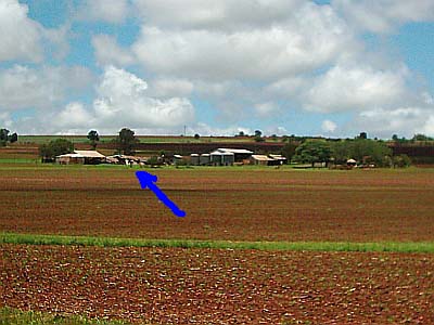
(2) (3) Below is a sequence of shots of a storm that I saw on the radar heading North East, moving out of the Eastern end of the Bunya Mountains. That afternoon I was due to go to my Auntie's to look at her computer. I decided to take a detour to look at a piece of land a friend is buying in Kingaroy. The view is across to the Bunya Mountains in the South West and across to the south to what is known as Coolabunia Hill or Usher's Hill. I had my cheapie Digital Camera with me to take a few shots of that view. When I arrived the storm I had been watching at home on radar was approaching Coolabunia Hill. It had been a very smoky day and the sun was shining from the west through the smoke and into the storm, hence the brownish colours. In the second shot I tried to expose the shot more to get the actual storm and ended up overexposing the core of the storm. The other shots are taken on the original setting. By the final shot the wind was getting fairly wild where I was and lightning was crashing around the place and I decided it was best to head off. I attempted to head further east to my Auntie's but due to the wild nature of the wind I decided to head west back to town and go out after the storm had passed. As it turned out it was a wise decision as that storm was actually a twister, mini tornado, whatever you prefer to call it and not more than a few kilometres away tore the tops out of trees and demolished a farm shed that had been standing for many years.
As I watched the storm it was noticeable how the lower clouds seemed to be rotating to the left.
The core looked very dense and as though hail was forming.
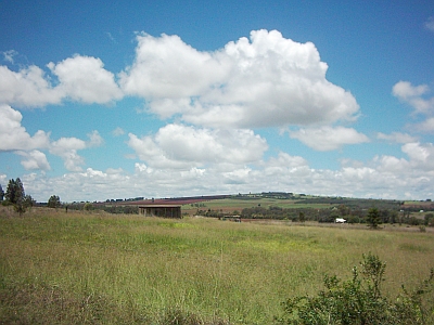
At this stage I decided to leave, as very strong wind was rushing towards me and lightning was striking. The picture on the right was taken a few days after the storm at the same position to give you an idea what it really looks like.
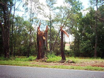
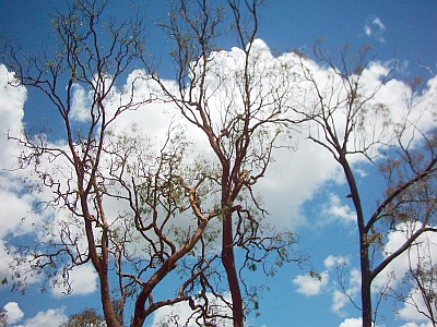
Above are trees torn down in the path of the "twister". They are near the Rest Area on the Kingaroy - Nanango Road.
In behind the trees above, about a kilometre South, is the farm where the shed was demolished
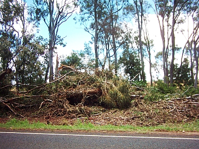
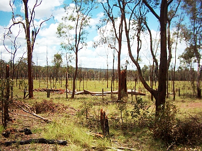
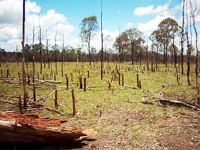
These shots were taken near McIlhatton Road near Barkers Creek on the Kingaroy - Nanango - Goomeri Road. If you draw a line across to the Bunya Mountains from this spot it takes in the Coolabunia damage, so I'm assuming it was the same "twister". To add further, in the South Burnett Times of that week is a story of a family whose home was damaged by a storm. It lies in a line to the north east of this site, in line with the damage at Coolabunia to the South West. The same "twister" in my mind. These shots show how small dead saplings had been snapped off as though a mower had passed over them at a height of around 200mm. Larger trees had been twisted off as well.
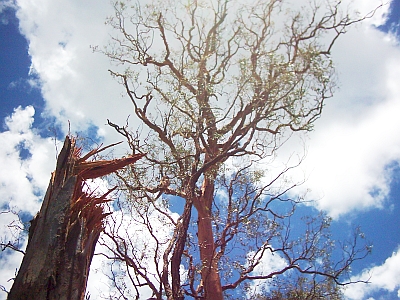
These shots were taken about 100 metres along the road. They show the trees missing foliage as though it was vacuumed off. The first shot shows how a large Eucalypt was twisted off.
Readings are taken at 9.00 am |
||||||||||||||||||||||||||||||||||||||||||||||||||||||||||||||||||||||||||||||||||||||||||||||||||||||||||||||||||||||||||||||||||||||||||||||||||||||||||||||||||||||||||||||||||||||||||||||||||||||||||||||||||||||||||||||||||||||||||||||||||||||||||||||||||||||||||||||||||||||||||||||||||||||||||||||||||||||||||||||||||||||||||||||||||||||||||||||||||||||||||||||||||||||||||||||||||||||||||||||||||||||||||||||||||||||||||||||||||||||||||||||||||||||||||||||||||||
|