Official readings for Kingaroy are taken at the Kingaroy Airport.
94549 - KINGAROY AIRPORT - 151.8398°E, 26.5737°S, 434m ASL
KINGAROY Town - 151.5072°E, 26.3232°S, 437m ASL
The rainfall ( in mm ) reported here is read from a commercial
rain gauge mounted in the open on a post 2 metres off the ground at our
home in Kingaroy itself, some 5km from the Kingaroy Airport.
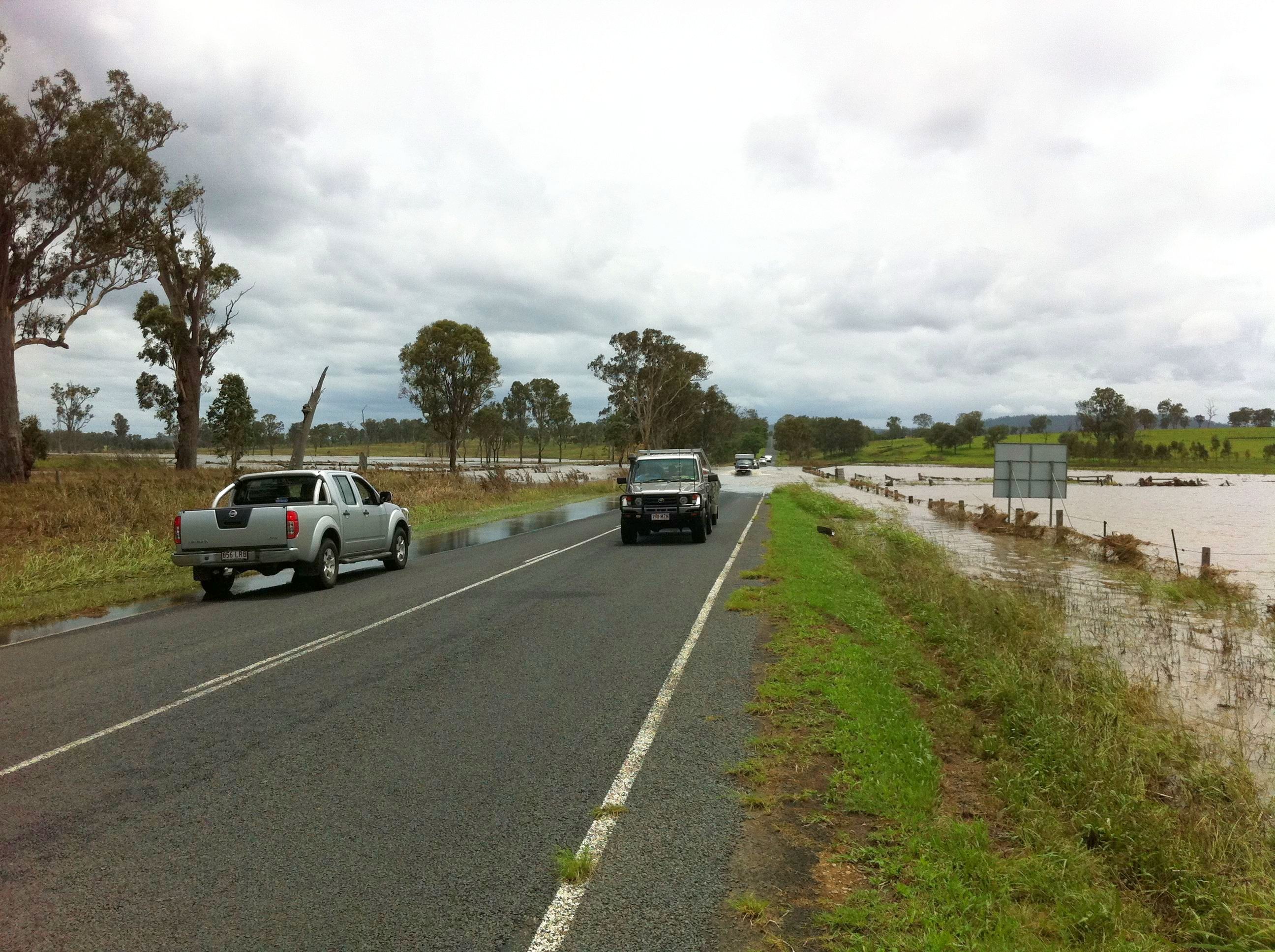
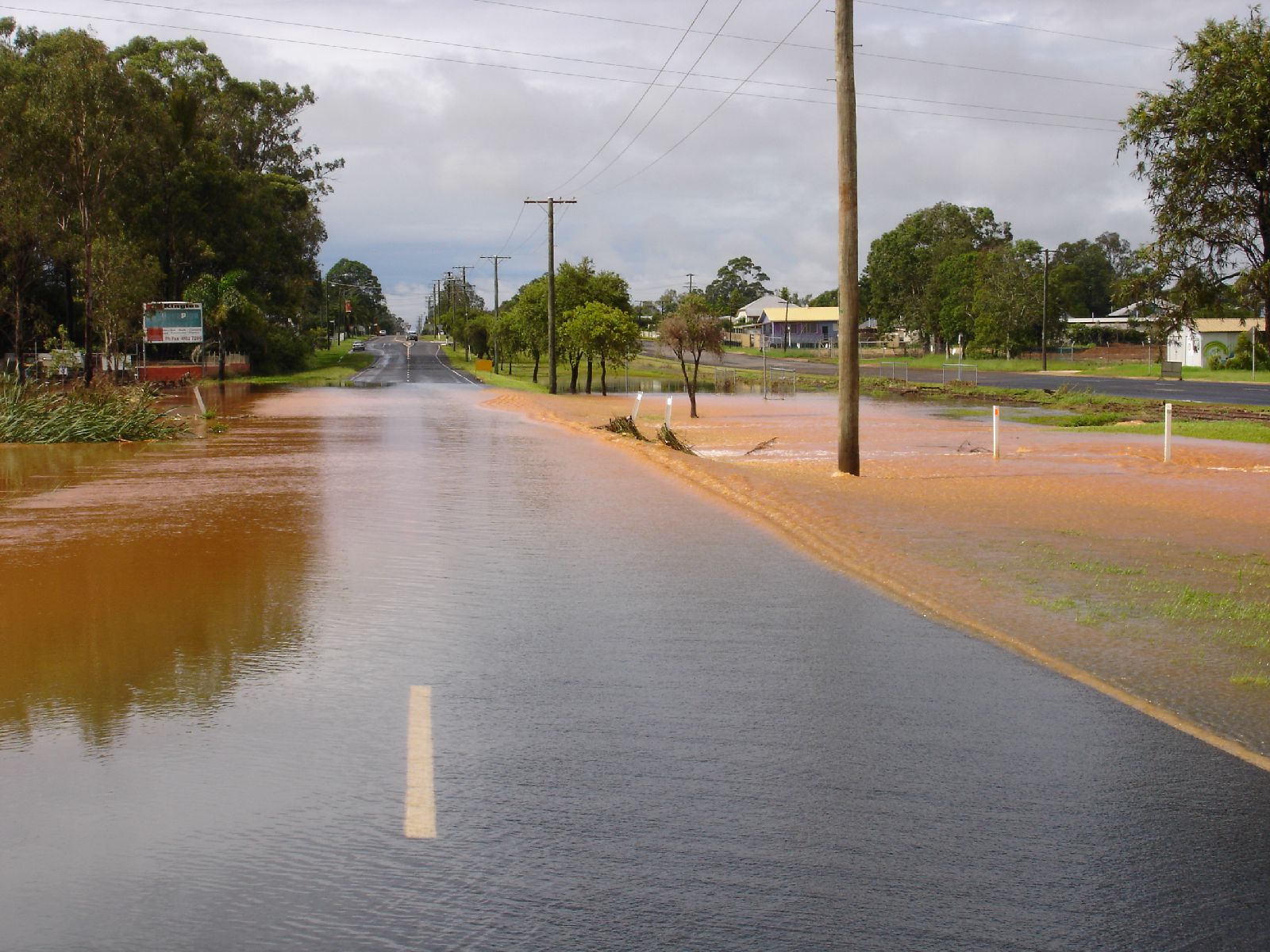
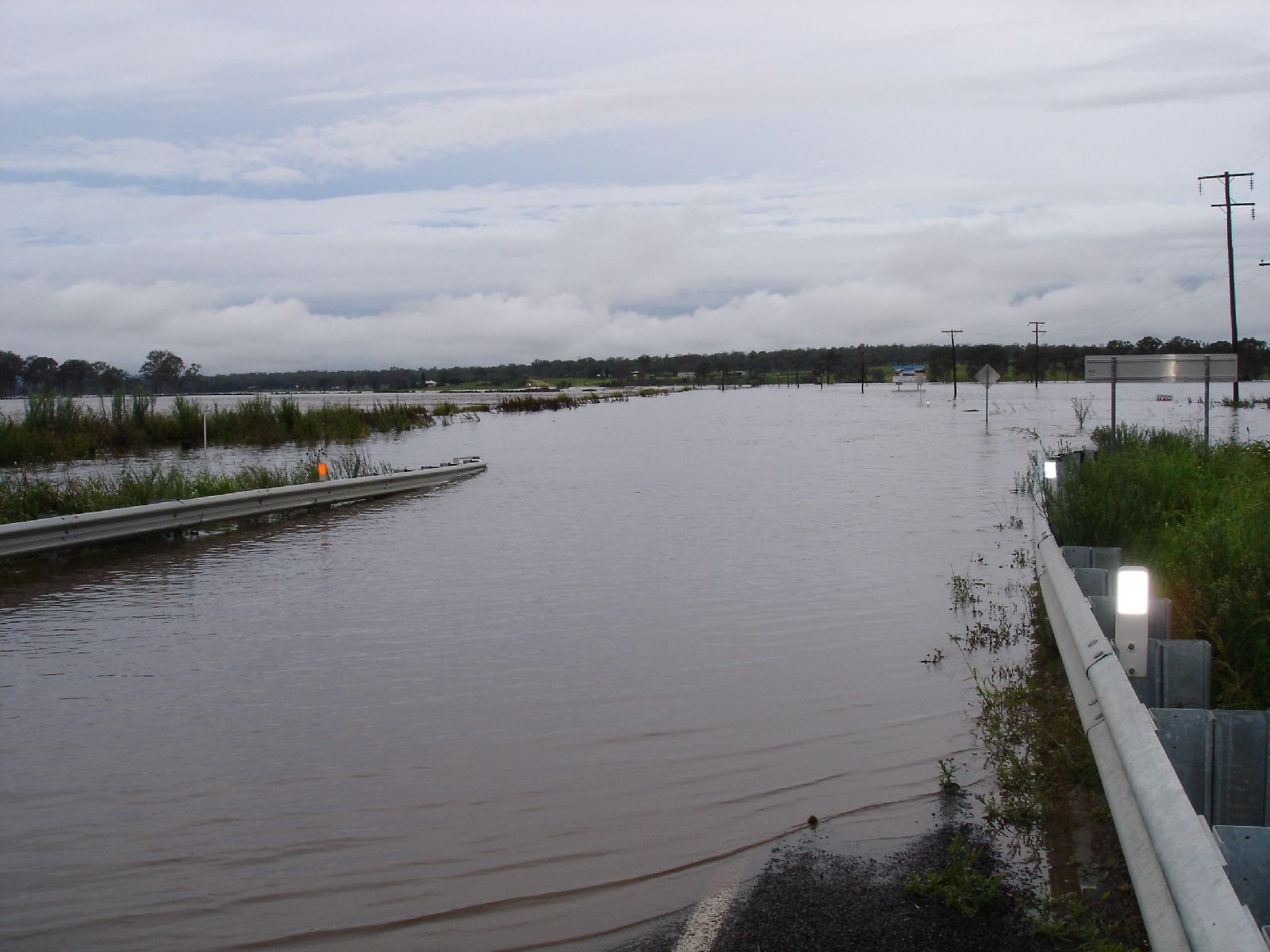
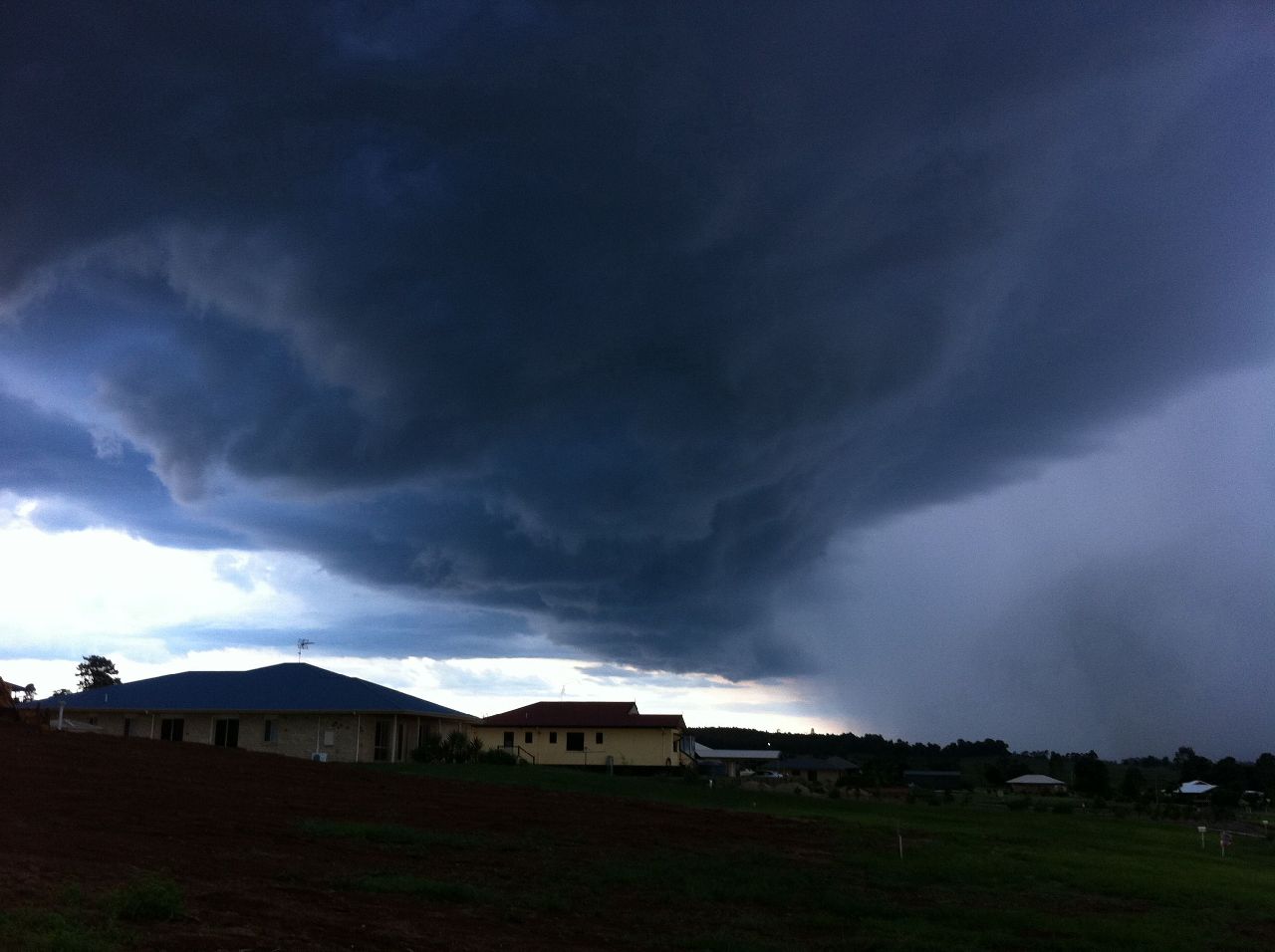
Because we had been having LOT of
rain in recent days, Judy and myself went for a drive to see how the
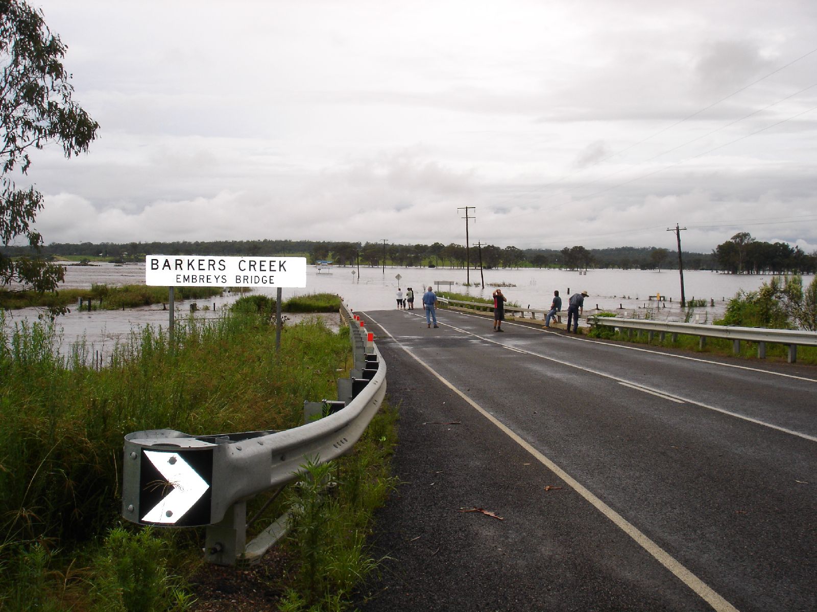
Barkers Creek was going.
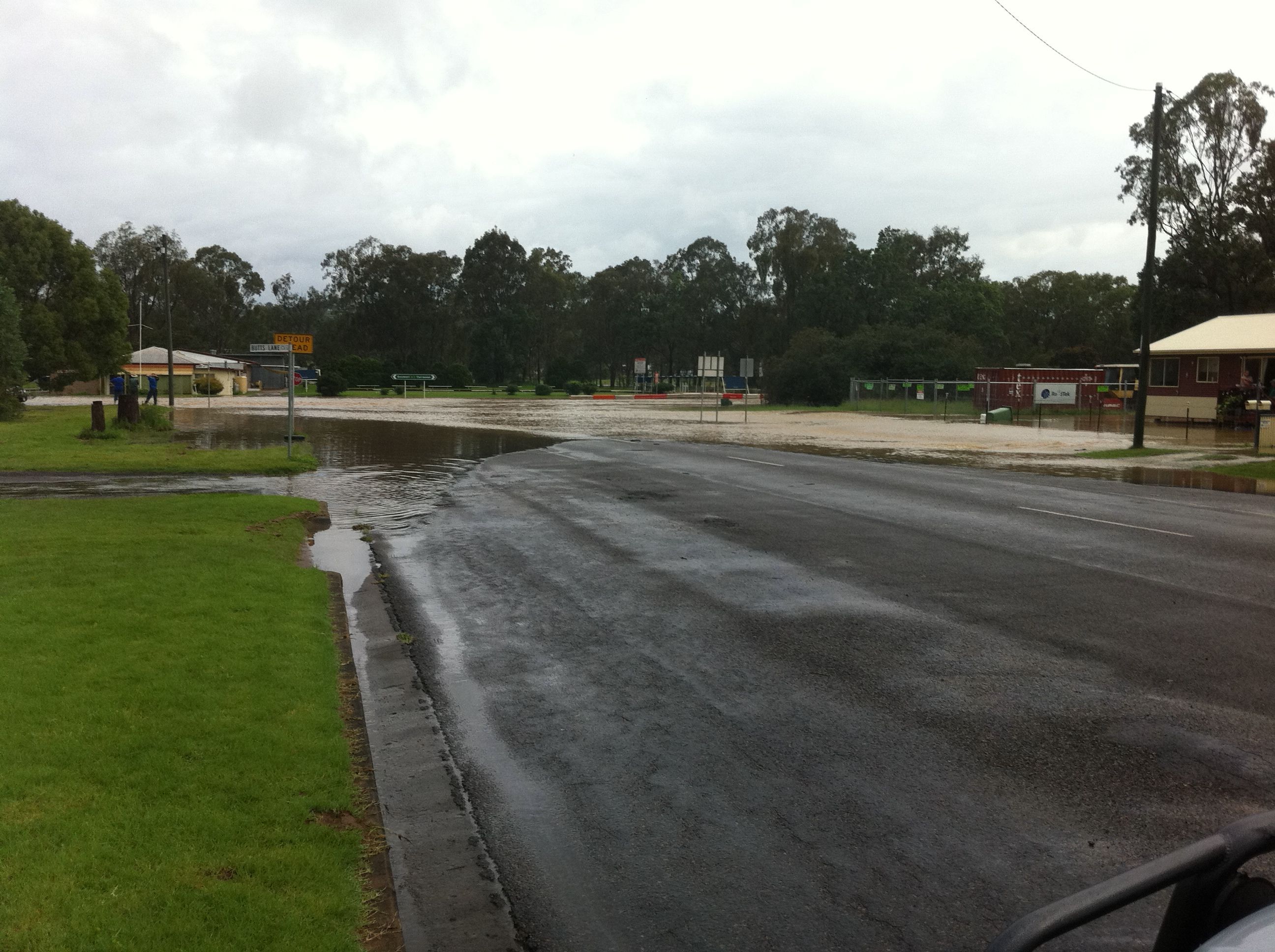
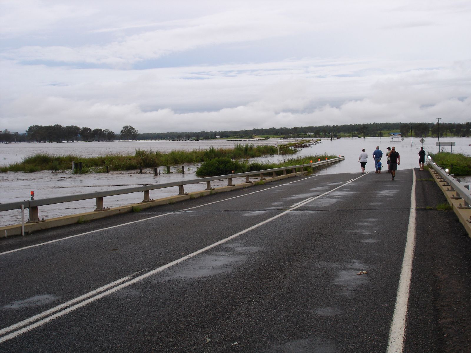
As it wasn't "over" at the bridge, I continued into Nanango.
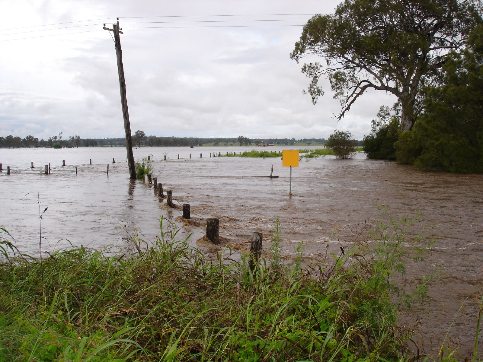
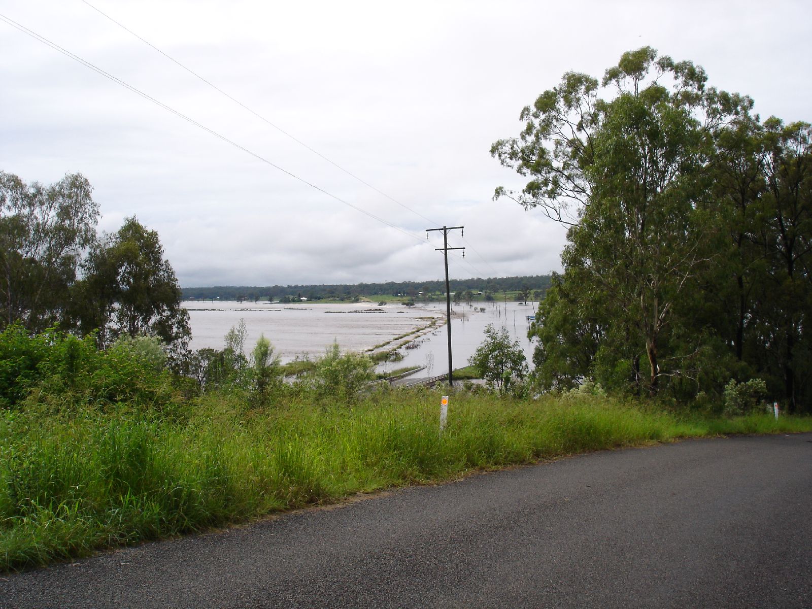
To my surprise, various areas around Nanango were flooded. One
such area was near the Nanango Bowls Club where they were doing
roadwork.
The road was well and truly closed by floodwaters.
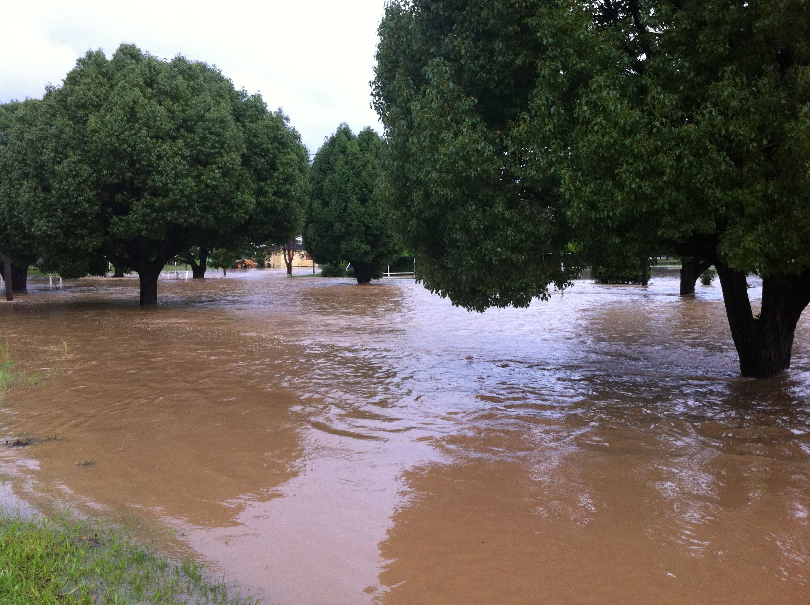
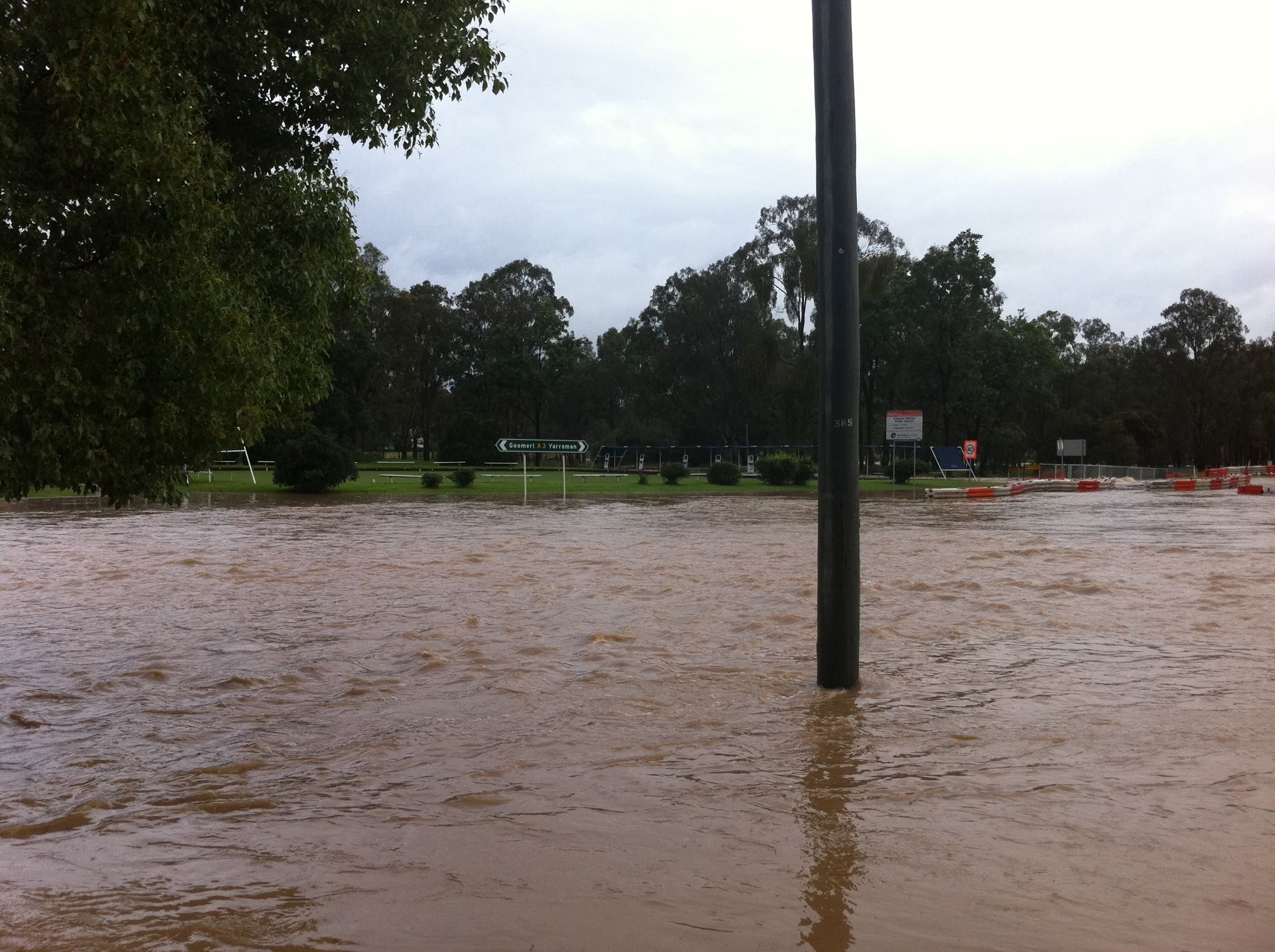
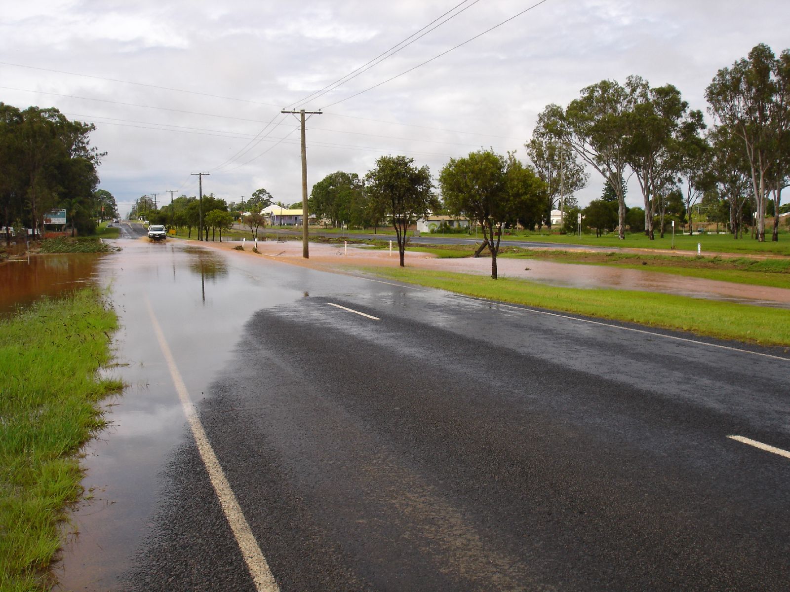
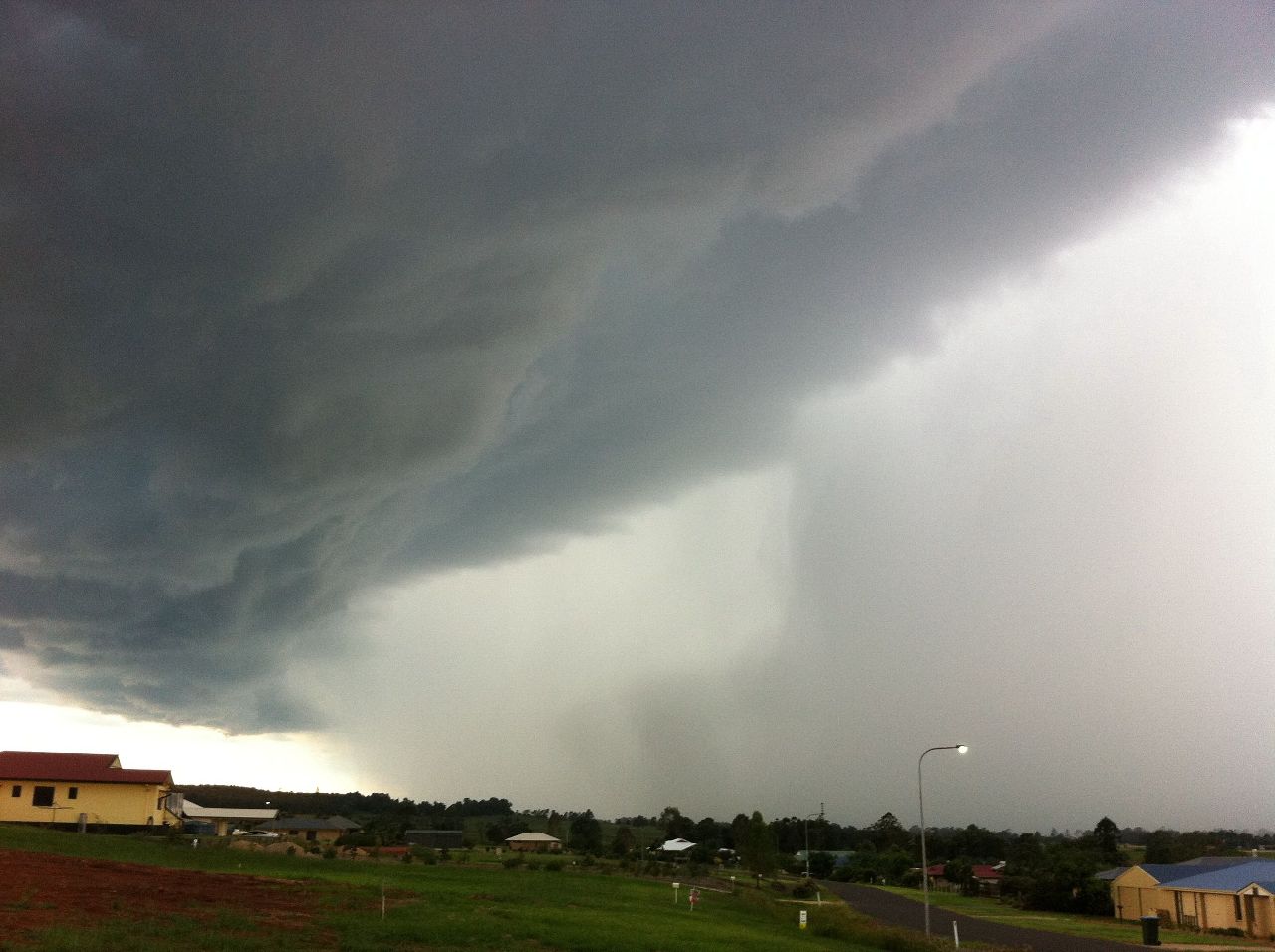
I didn't have my
camera to take a pic. Judy reminded me that my new iPhone4 had a camera. I
hadn't used it but decided to try it out.
The link below is the result. Keep in mind that what you are seeing is
my attempt at taking a "still" picture. While I found a button to click,
I didn't workout till a few seconds later that I was actually taking a
video!
So, the moving about was me attempting to frame the shot. Once I
realized what I was doing, I held the phone more firmly. I was amazed at
how it turned out and decided to put it on YouTube, as at the
time, it seemed very impressive. Since then though, it has paled into
insignificance.
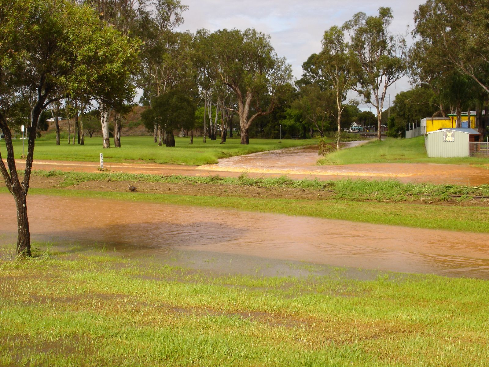
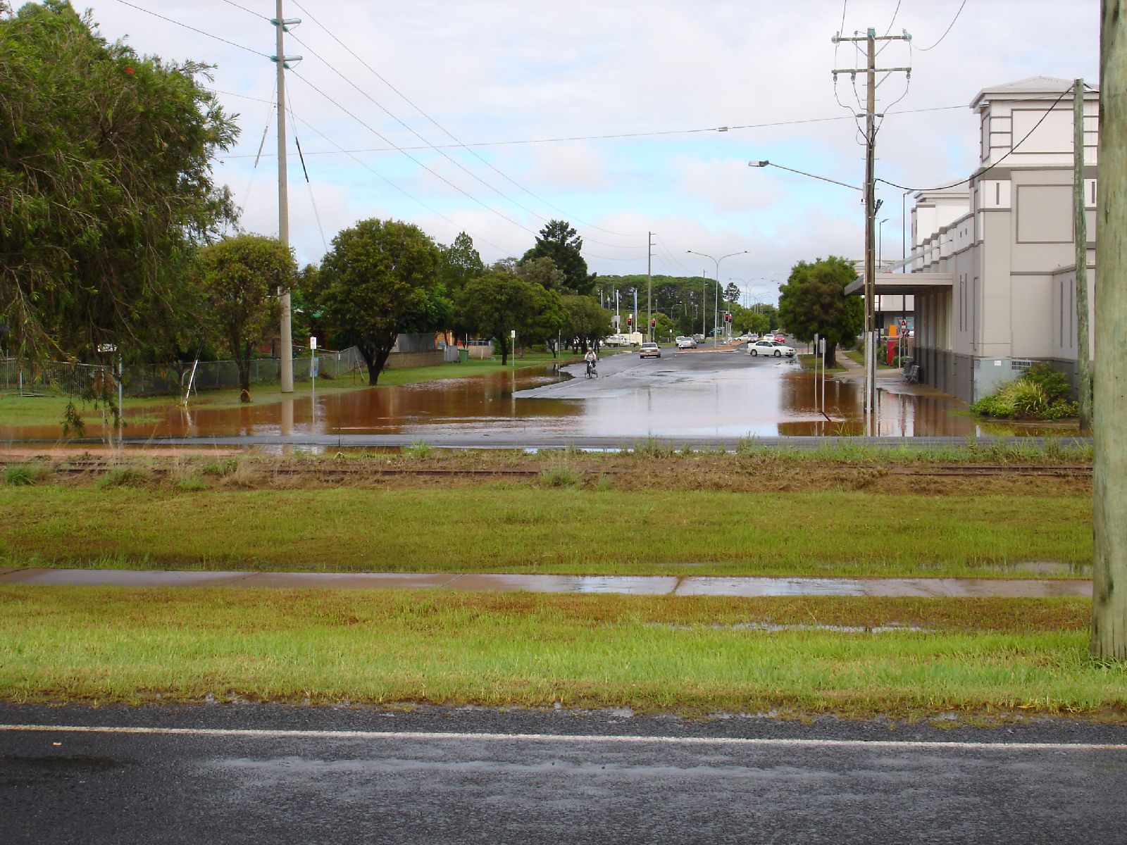
Below are the still pics I eventually took after I worked out the
buttons.
(2)
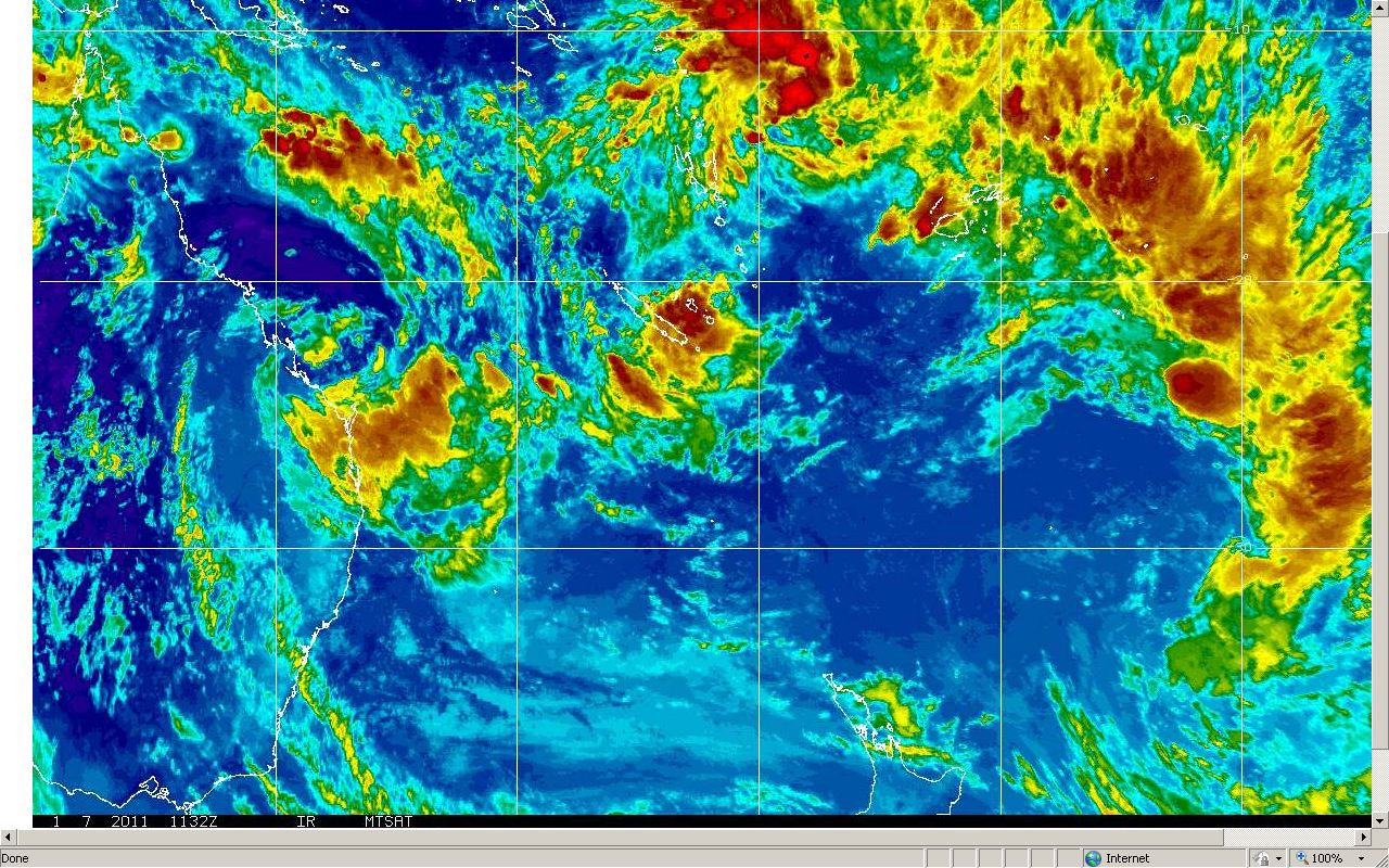
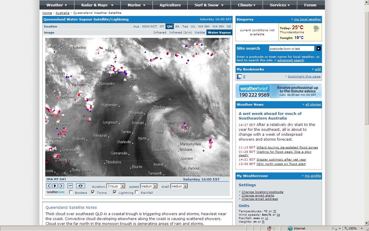
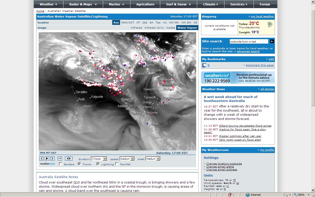
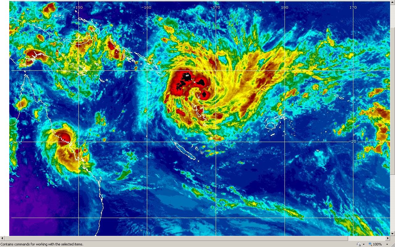
Below are images I had been following.
There was a HUGE (to me anyway) Upper Air Low pressure system,
with the centre virtually stationary over the Rockhampton/Gladstone area.
My brother lives in Tannum Sands, near Gladstone.
I rang him and he could see storms out to sea, which seemed to be
rotating in the same area for hours.
That made sense to me, based me on the
pictures I was seeing on the computer (see below).
At the same time, moisture was feeding in from the sea, over the
area, Fraser Island and below, from the bands of the Low.
I continued to follow the system. It very slowly moved South and
slightly West.
A line of storms, and it was virtually a line of storms, from out to
sea, over the coast and inland to our area, dumped huge rainfall.
The line of storms was so linear, that looking at the satellite pictures
in animation, it seemed as though someone with a huge hose was streaming
massive volumes of water from the sea onto the land.
Over the next couple of days, that line wavered and flooded areas up to
the level of Fraser Island and then back down over the
Sunshine Coast.
The western end of the line varied from our area to
up around Gayndah.
This resulted in Gympie and
Maryborough being flooded.
Even inland towns like Kilkivan
and Woolooga had massive flooding.
On the 10th of Jan, the line moved over our area, with continuous storms with thunder
and lightning, dumping huge falls, which flooded our creeks, dams and
rivers.
That afternoon, the line had extended over the
Toowoomba area where it dumped amazing amounts of flood rain which
caused terrible flash flooding and loss of lives in Toowoomba and,
to the east of Toowoomba in the Lockyer Valley,in
places like Murphy's Creek, Postman's Ridge, Withcott
and Grantham.
Whole houses and businesses were washed away with people in and on them.
At the same time the runoff from the catchment area - part of which is
our area - of the Brisbane
River was filling the Wivenhoe Dam.
Even though they tried to
manage the release of the water from the Wivenhoe Dam, the volume
of inflow was too much and huge volumes of water had to be released.
The water from the Toowoomba and Lockyer Valley areas
meets the Brisbane River just below the Wivenhoe Dam.
The effect of this volume of water combining, meant Ipswich and
Brisbane were flooded in a similar way to the 1974 floods.
The results were no great surprise to many of us who follow weather, as
many conversations had taken place about how the ground was so saturated
from months of wet weather, that instead of
rain soaking in, it would run off into waterways.
I was living in Brisbane in 1974 and saw the floods.
I heard
how the Wivenhoe Dam was to be built as a "flood mitigation"
measure to prevent Brisbane from ever flooding again.
This was to mean that the huge volumes of water heading towards
Brisbane from the catchment area, was to be held and then released
when the rain event was safely over.
In recent years though, with the many years of drought, people looked to
the Wivenhoe Dam for drinking water, as many commentators were
saying,
because of "climate change", huge areas of Australia
would become dry.
Generations had grown up with only lack of water in
their mind.
I don't think many people could understand the events of 1974
and various flood years earlier back to the 1800's.
A lot thought
of our stories as fanciful and exaggerated.
To me, even though the dam had a "flood compartment", which was
supposed to cope with flood waters, the idea that the dam had
to be "100% full", as the people and media on the coast kept harping on about,
caused the loss of the necessary space to buffer the huge volumes of water
that were possible from the Brisbane River catchment area.
That lack of space lead to too much water being released, because of
real fears of the dam overflowing,
during the massive flow of water
downstream of the dam, from the Lockyer Valley, which then
flowed on to Brisbane and Ipswich at a critical time.
The people living now, hopefully will pass on their
experiences of the 2011 Floods and hopefully, their offspring will
take heed.
During the past few months, massive flooding has occurred over huge areas
of Queensland,
including Toowoomba, Lockyer Valley, Dalby, Condamine,
Chinchilla, St George, Warwick, Ingham,
Townsville, Rockhampton,
Emerald, Theodore, Bundaberg, Kilkivan and
Woolooga
and no doubt I've
missed somewhere.
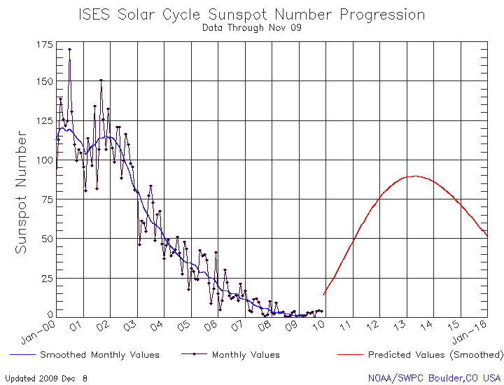
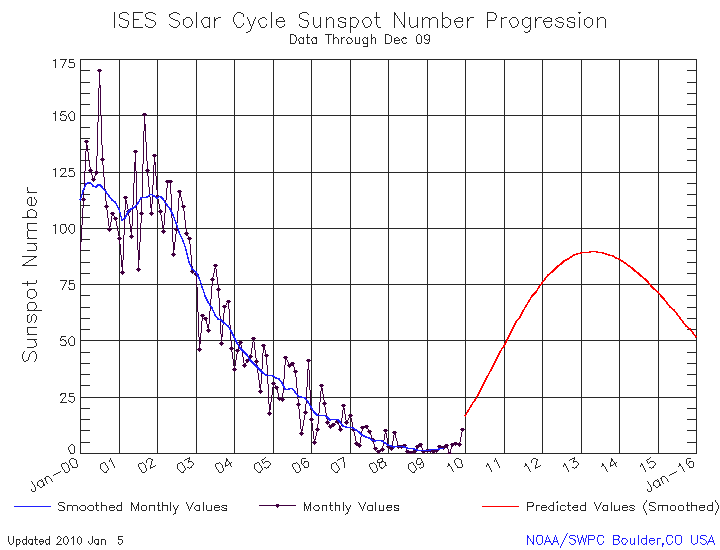
My thoughts that Sun Spot activity causes weather
changes have been reinforced by the recent events.
If you look at the
graph, you can see the rising numbers which coincided with the big changes in
our weather.
I feel that the changes in our weather here on Earth,
that we have named El Nino, La Nina and the SOI,
are the resultant effects of changing Sun Spot activity,
on the surface and atmosphere of the Earth.
Therefore, they are NOT leading
indicators.
To me, Sun Spot activity is the leading indicator. Be they rising
or falling numbers.
But that's just my layman's thoughts, from observations over my 61 years
here on Earth.
Time will tell.
Below is an early stage of the Upper Air low in Colorized Infra Red
that I continued to monitor.
Because I saw the massive size of it, and how it was dragging huge
volumes of moisture off the Coral Sea and how stationary it was for so
long, and therefore the potential massive effects, I saved the pictures
below.
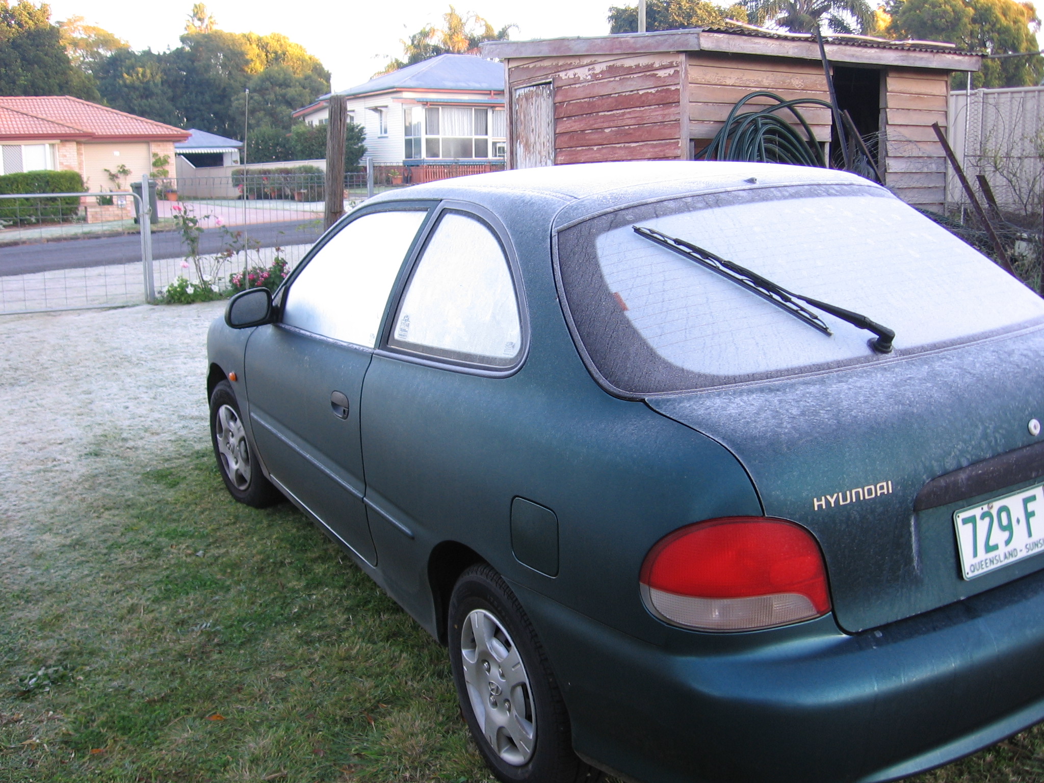
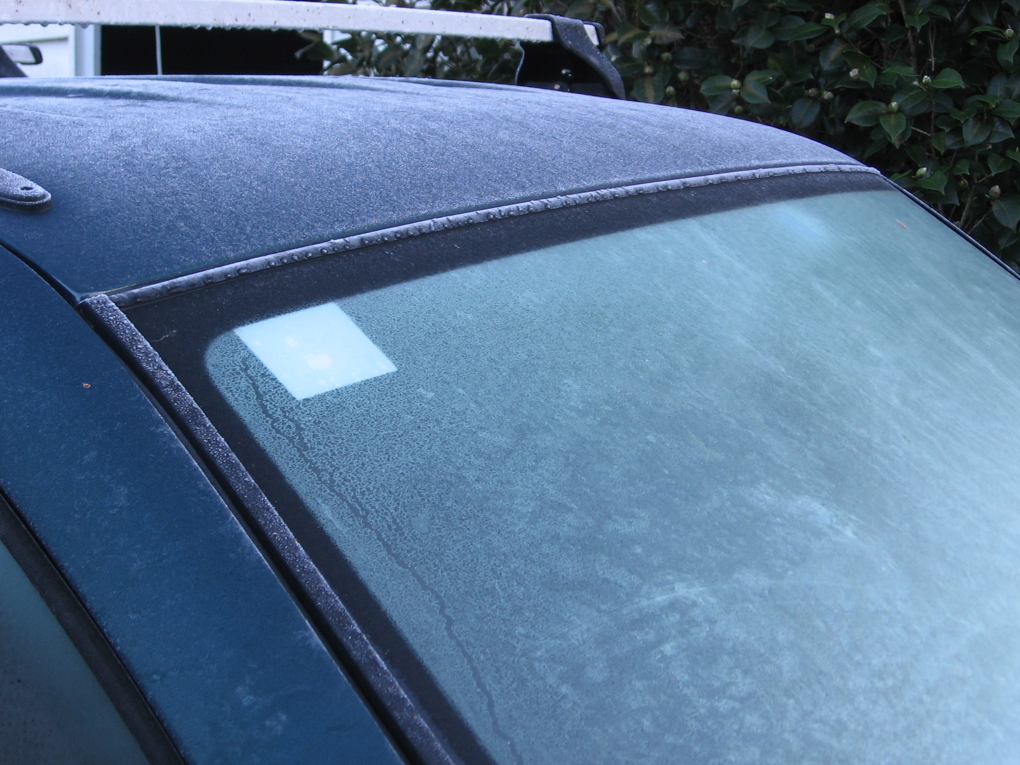
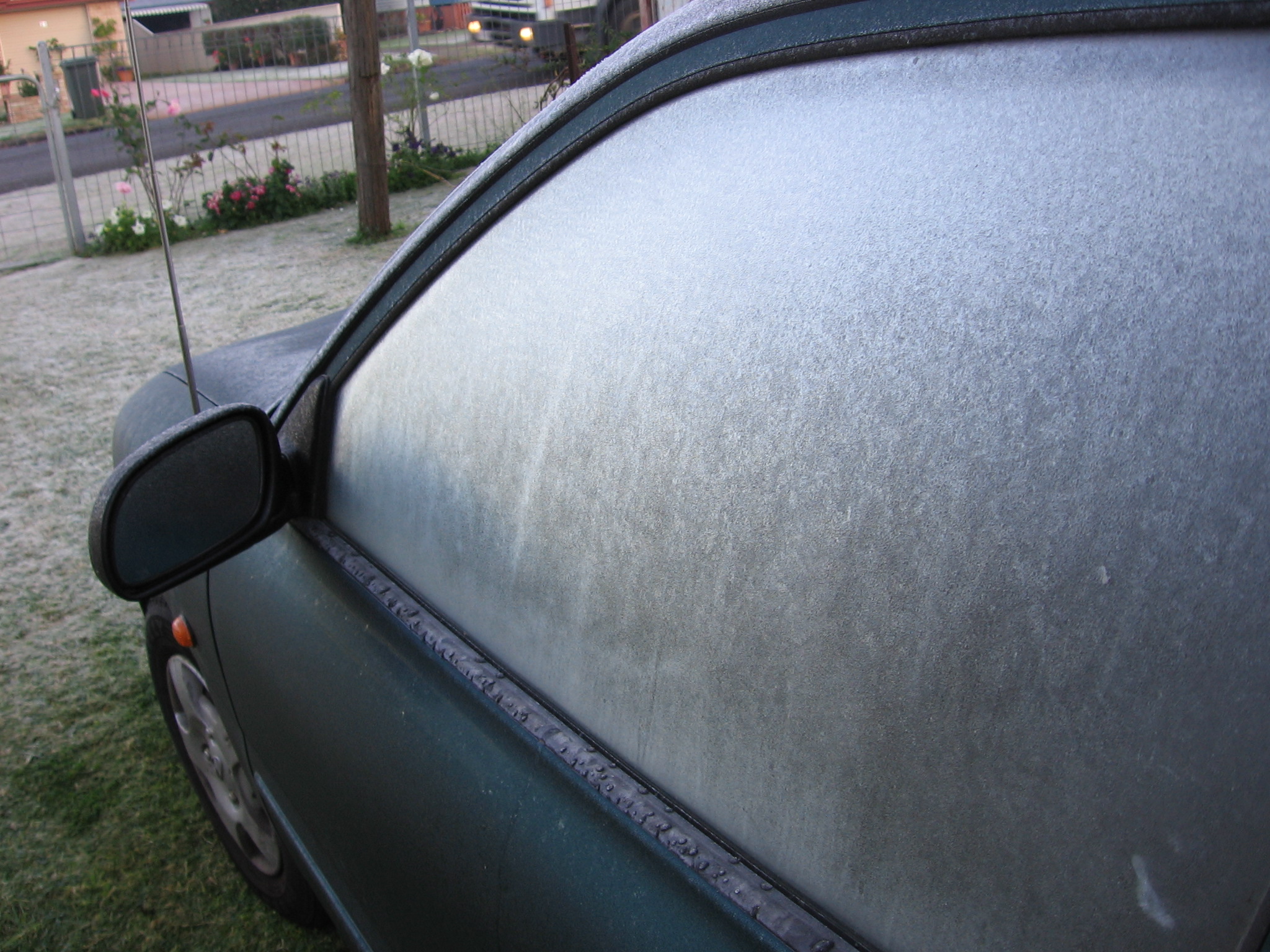
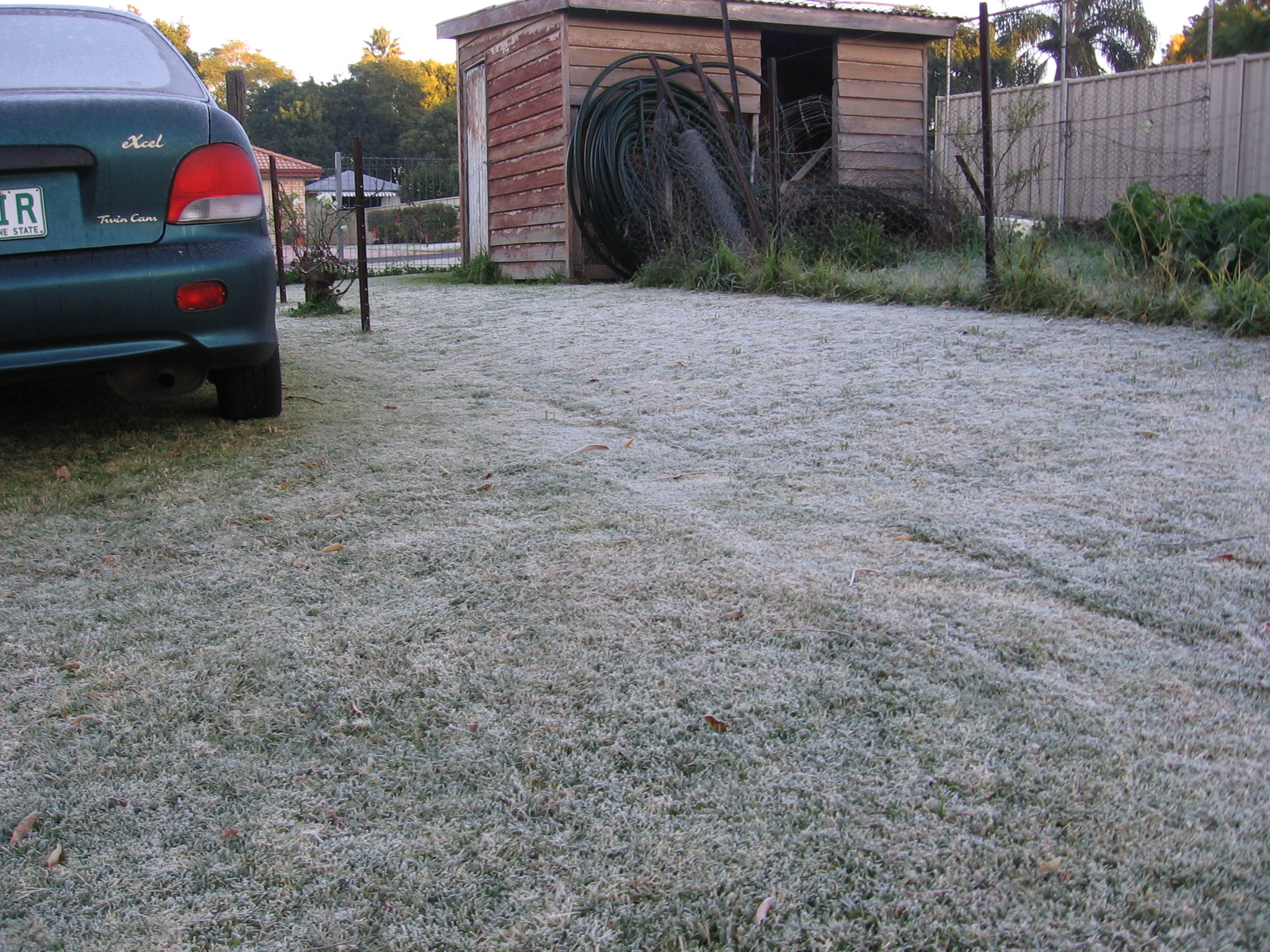
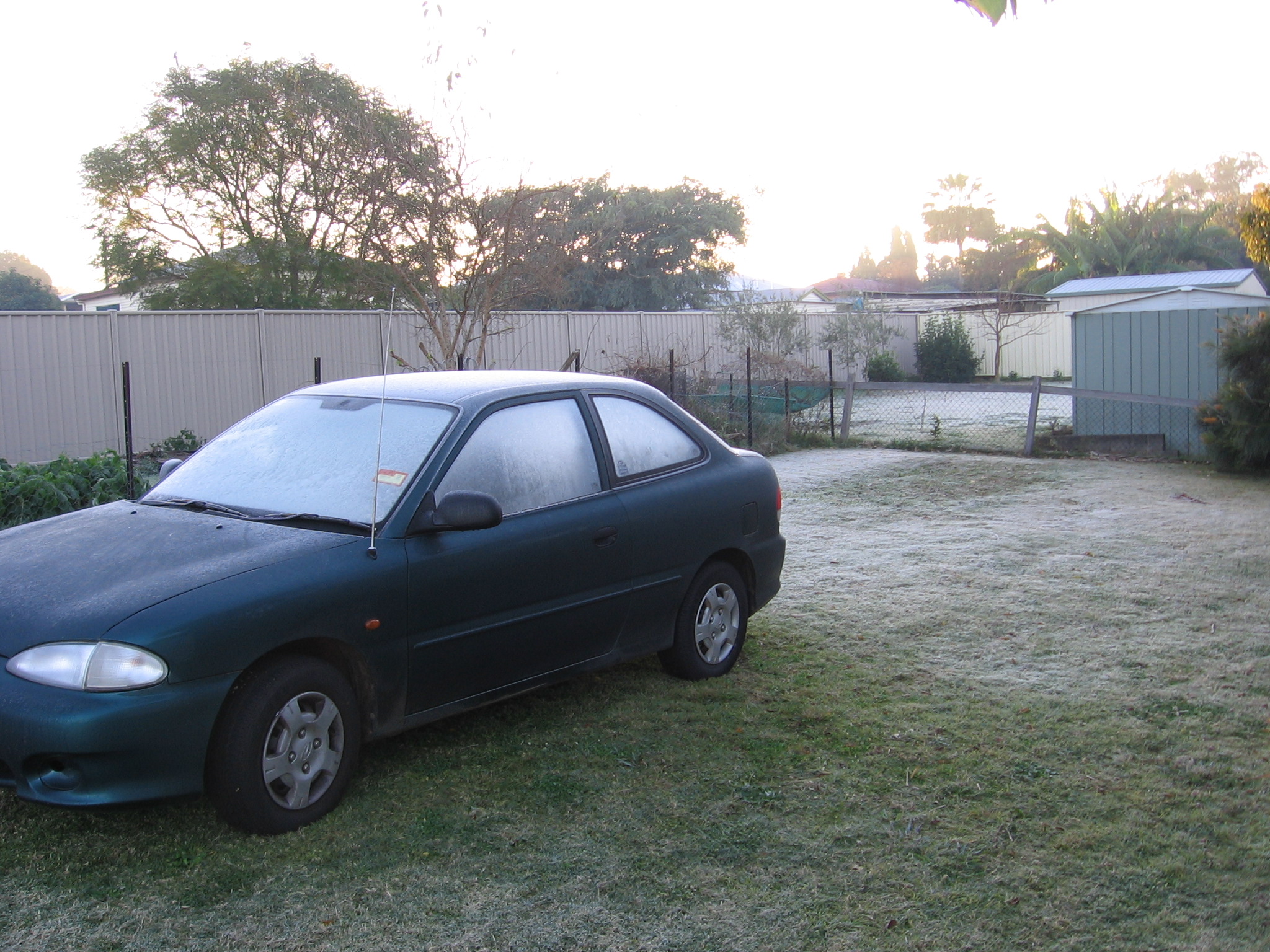
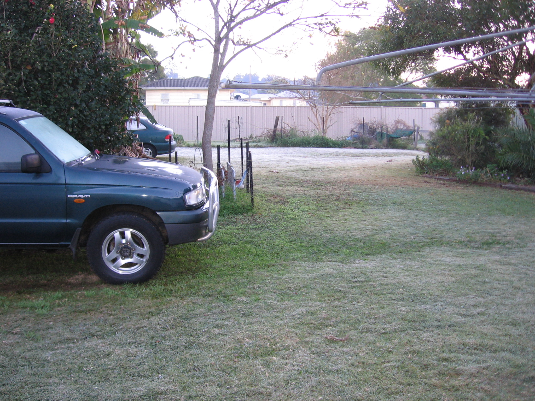
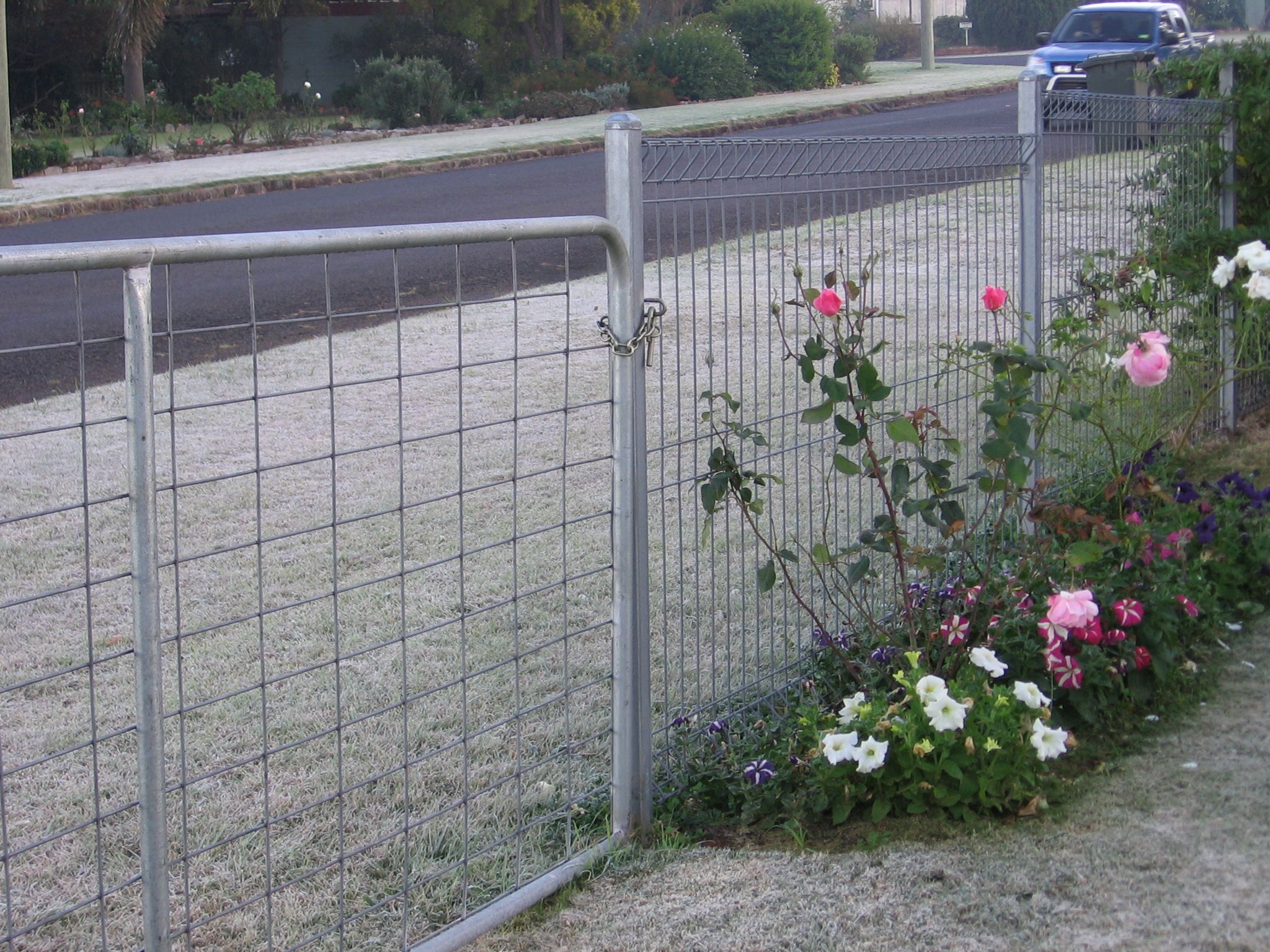
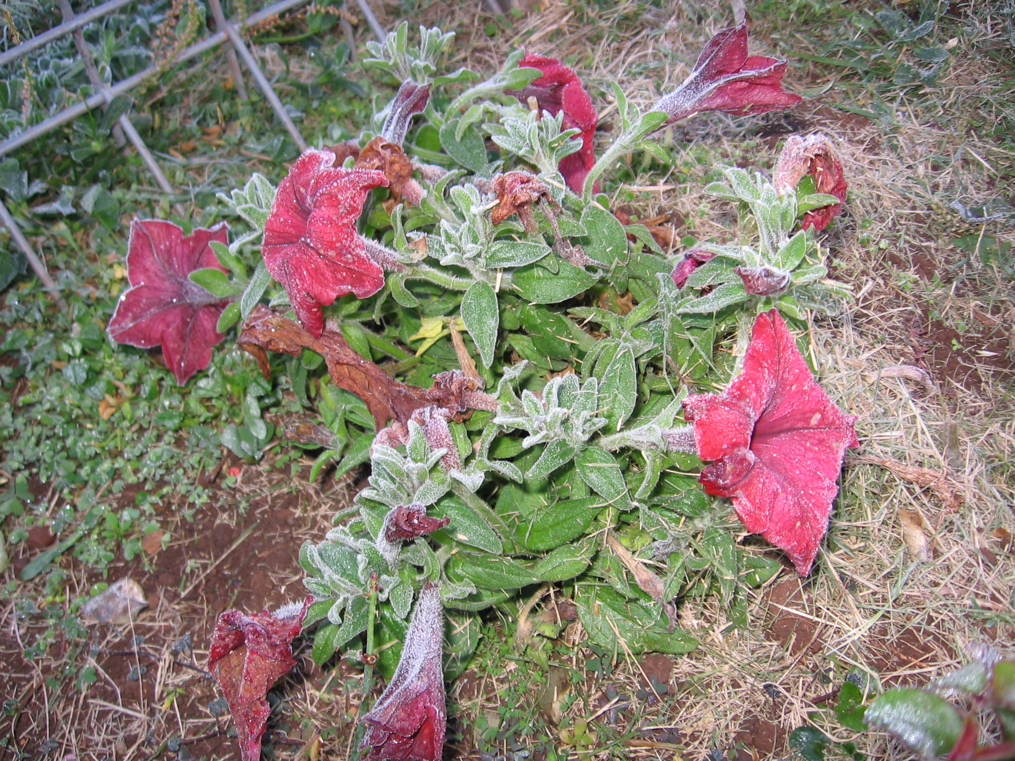
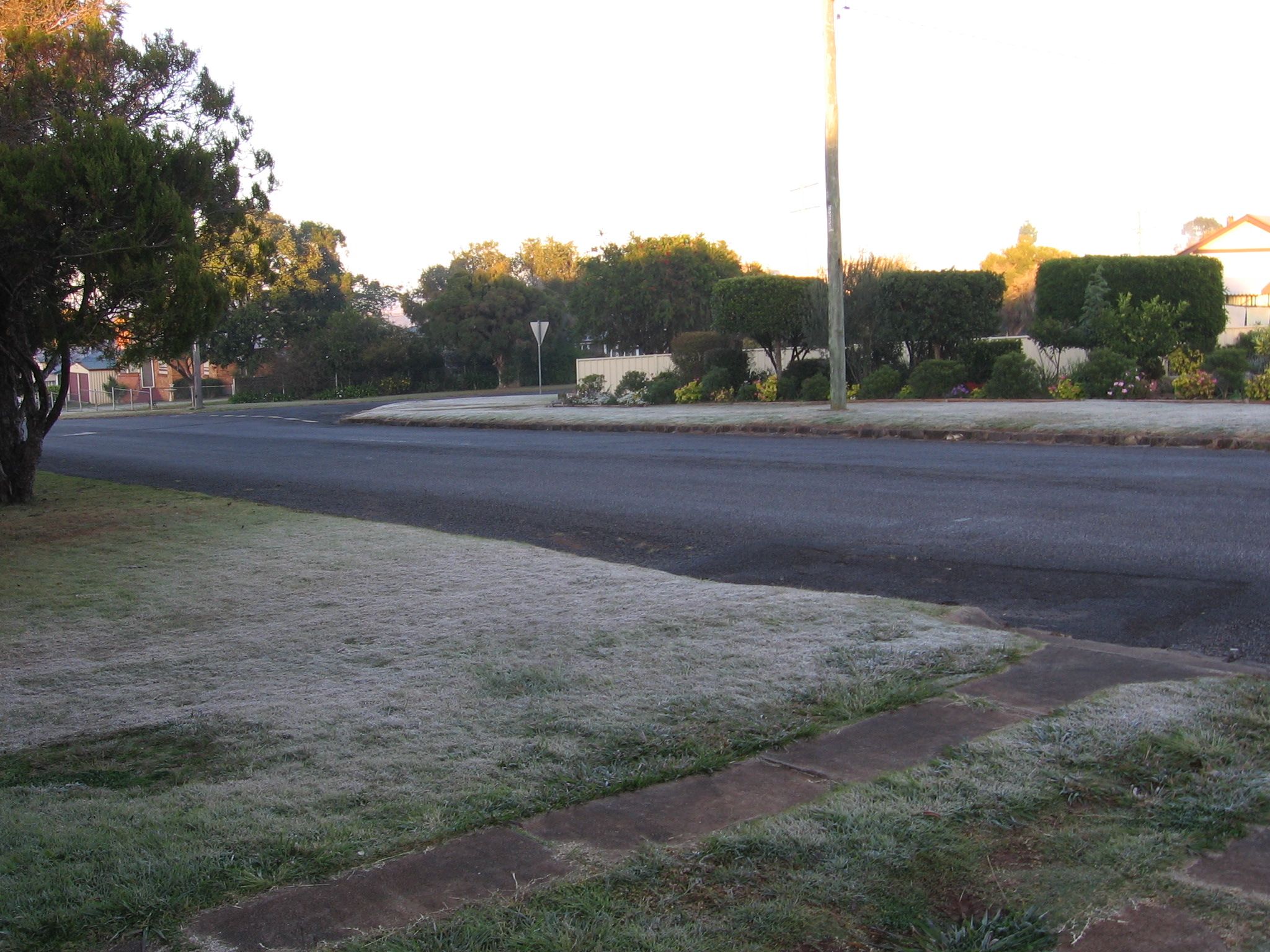
Frost has arrived in our backyard. Below are a few pics.
I expect a lot more frosty mornings, as this year reminds me of my
childhood, when we had very wet Summers and very cold Winters.
Date
Jan
Feb
Mar
Apr
May
Jun
Jul
Aug
Sept
Oct
Nov
Dec
1
2
16
3
14
.5
4
20
1
1
1
5
35
6
14
1
4
1.5
6.5
7
(1)
16
1
12
18.5
8
(2)
28
31
33
9
16
3.5
3.5
30
5
4.5
10
48
6
30
11
(3)
94
9
12
2.5
9
7.5
4.5
13
4.5
14
15
9
16
12
4.5
2.5
17
24
2
18
4.5
19
(4)
12
17
12.5
20
11
33
(7)
21
9
5
4
22
28.5
3.5
23
3
24
11
7
.5
25
1
26
27
10
18
28
.5
20
29
.5
2
30
(5)
11
3
7
31
(6)
17
Monthly
Totals
305
58
98.5
29
57
15
14.5
37
13
101
1.5
108.5
Days Rained
14
5
7
6
5
3
3
3
2
10
2
8
Cumulative
Rainfall
305
363
461.5
490.5
547.5
562.5
577
614
627
728
729.5
838
Cumulative
Days Rained
14
19
26
32
37
40
43
46
48
58
60
68
2010 RAINFALL
Monthly
Totals
68
102.5
237
36.5
30
8
18
104.5
134.5
104
26
416
Days Rained
7
8
11
4
6
3
3
6
10
7
7
20
Cumulative
Rainfall
68
170.5
407.5
444
474
482
500
604.5
739
843
869
1285
Cumulative
Days Rained
7
15
26
30
36
39
42
48
58
65
72
92
Date
Jan
Feb
Mar
Apr
May
Jun
Jul
Aug
Sept
Oct
Nov
Dec
1
.5
46
.5
(4) 20
1
1
1
2
.5
13
58.5
30
3
49
5.5
3
4
6
1
3.5
5
6.5
10
17
6
(1) 90
60
8
4
7
14
8
28
8.5
12
4
3.5
9
2.5
2
39
3
10
1.5
11
4
59
10.5
9.5
12
12
2.5
12
51
13
(2)
3
.5
14
15
1
1.5
2
16
20
28
17
2.5
(3)
61
18
2.5
10
3.5
1.5
1
19
1.5
1.5
6.5
19
20
5
18
9
(5)
74
21
1
9.5
15
22
1.5
1.5
23
5.5
29
24
13
11
25
14
2
1.5
4
26
3.5
19
27
50
28
1
26
29
5
8
7.5
27
6
30
28
1
5.5
2.5
31
Monthly
Totals
68
102.5
237
36.5
30
8
18
104.5
134.5
104
26
416
Days Rained
7
8
11
4
6
3
3
6
10
7
7
20
Cumulative
Rainfall
68
170.5
407.5
444
474
482
500
604.5
739
843
869
1285
Cumulative
Days Rained
7
15
26
30
36
39
42
48
58
65
72
92
2009 RAINFALL
Monthly
Totals
59.5
99
14
48.5
62.5
82
0
0
21
41
24
123.5
Days Rained
8
9
7
8
6
7
0
0
3
7
5
10
Cumulative
Rainfall
59.5
158.5
172.5
221
283.5
365.5
365.5
365.5
386.5
427.5
451.5
575
Cumulative
Days Rained
8
17
24
32
38
45
45
45
48
55
60
70
Date
Jan
Feb
Mar
Apr
May
Jun
Jul
Aug
Sept
Oct
Nov
Dec
1
1.5
2
2
6
5
3
1
2
.5
3.5
1
4
1
3.5
.5
5
5.5
19
8
9
6
3.5
(plus a beetle)
7
2
4
.5
8
11
9
10
.5
3.5
11
8
.5
1
12
.5
.5
1
13
2
3.5
1
.5
34
14
17
17
4
3.5
15
4
16
8.5
30
17
1
4.5
18
13
19
10
1.5
20
5
46
.5
21
60
8
22
.5
.5
23
34
19.5
1
24
1.5
2.5
1
25
26
2
.5
3
1
27
13
46
24
9
28
1
29
11
30
24
31
2008 RAINFALL
Monthly
Totals
115.5
189
22
2.5
34
32
92
8
24.5
28
116
121.5
Days Rained
13
14
3
2
2
5
12
2
4
6
9
10
Cumulative
Rainfall
115.5
304.5
326.5
329
363
395
487
495
519.5
547.5
663.5
785
Cumulative
Days Rained
13
27
30
32
34
39
51
53
57
63
72
82
Date
Jan
Feb
Mar
Apr
May
Jun
Jul
Aug
Sept
Oct
Nov
Dec
1
1
1
2
1
11
3
3.5
1
10
4
10
17
5
3
5
1.5
60
.75
12
6
30
1
4
9
16
7
31
4
10.5
8
40
5
31
4
12.5
9
18
14
10
1.5
2
11
16
13
12
18
11
1
13
8
2
14
5.5
1
2
15
16
1
1.5
2
7
17
2.75
2
18
1.5
6
19
1
15
20
1
54
21
5
5.5
22
5
1.5
3
23
3.5
24
28
25
11
6
26
6
.5
27
13
3
6
.5
28
6.5
10
2
4
58
29
1.5
9
2
1.5
30
23
4
31
11
11
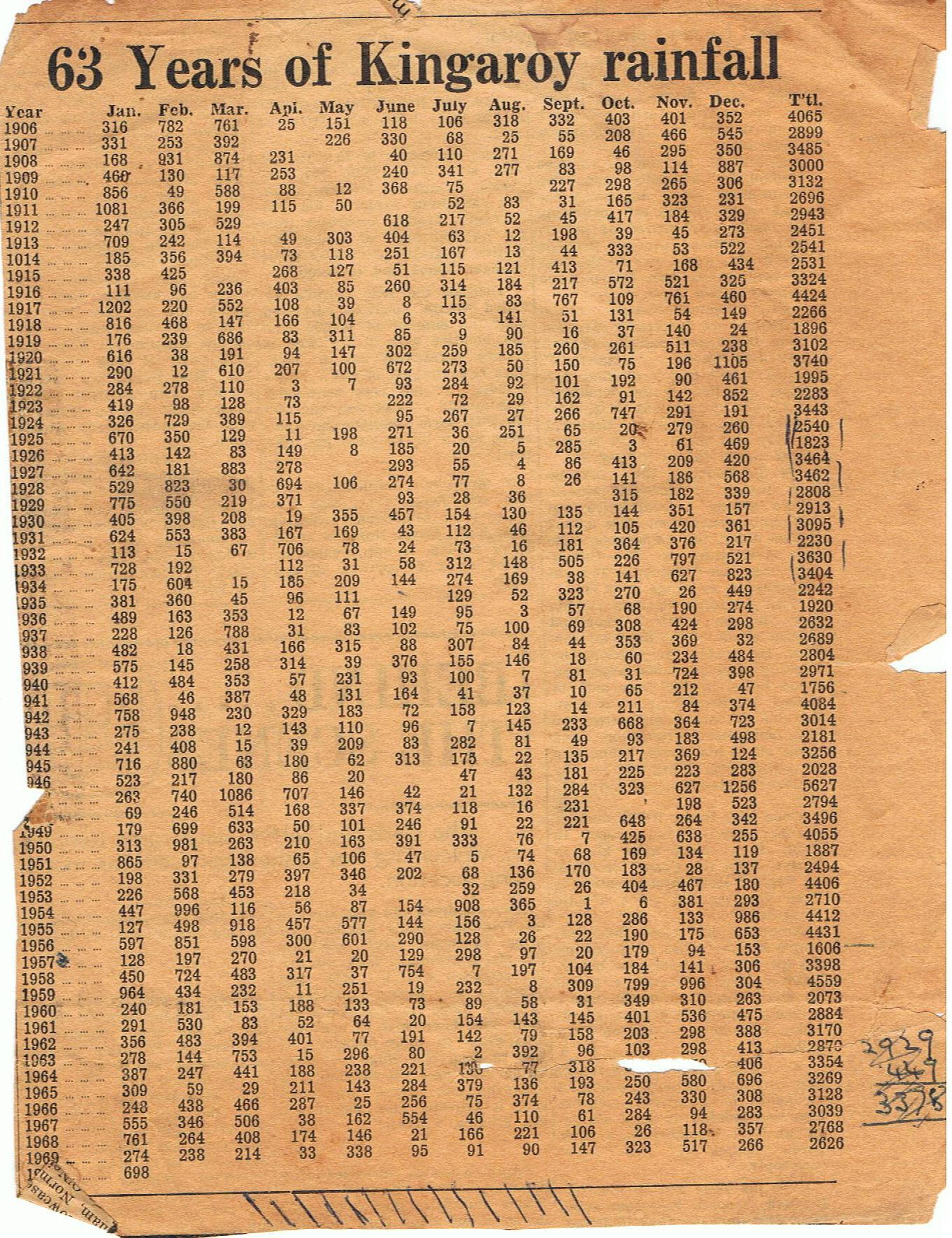
The above chart, converted from points to mm, is produced from a
newspaper clipping in 1970.
A schoolmate, Don Knopke, found it while cleaning his Uncles office.
For
comparison with actual rainfall, as I believe that the Sun controls the majority of our
( the whole of the Earth ) weather, below are graphs showing the
changing sunspot activity.